Blog
How Cloud Computing Is Transforming the GIS Landscape
The integration of cloud technology has redefined spatial analysis, ushering in a new era of accessibility, scalability, and collaboration. How Cloud Computing Is Transforming the GIS Landscape lies in its ability to process vast amounts of geospatial data seamlessly over distributed networks. By leveraging cloud resources, organizations can conduct complex analyses faster, enabling smarter decision-making across industries such as urban planning, disaster management, and environmental monitoring.
From Local Servers to the Cloud: The New Era of GIS Technology
Traditional GIS systems depended heavily on local servers, limiting storage, processing power, and accessibility. The migration to the cloud marks a paradigm shift, transforming GIS from isolated desktop systems into dynamic, interconnected environments. This new era allows users to access and update spatial data in real time, eliminating bottlenecks associated with hardware maintenance and enabling efficient global operations through Cloud-Based GIS Solutions.
The Role of Cloud Computing in the Evolution of Geographic Information Systems
Cloud computing has become the driving force behind the modernization of Geographic Information Systems (GIS). Traditional GIS architectures once depended heavily on on-premise servers, proprietary databases, and desktop software for spatial analysis. However, the emergence of cloud computing has redefined this model by introducing on-demand scalability, distributed processing, and real-time analytical capabilities.
By migrating GIS infrastructure to cloud-based environments, organizations can now leverage virtualized resources that automatically scale to meet fluctuating computational demands. This eliminates the bottlenecks associated with hardware limitations and maintenance overhead. Furthermore, cloud platforms enable seamless integration with emerging technologies such as Artificial Intelligence (AI), Internet of Things (IoT), and Big Data Analytics, all of which amplify the analytical depth and responsiveness of spatial systems.
For instance, IoT-enabled sensors can continuously stream environmental data to cloud GIS systems, where AI models process it in real time to predict weather patterns, track deforestation, or optimize traffic flow. This synergistic ecosystem illustrates how cloud computing is transforming the GIS landscape, making spatial intelligence faster, smarter, and more actionable than ever before.
Why Cloud-Based GIS Is the Future of Spatial Data Management
The future of spatial data management is undeniably cloud-centric. Cloud-based GIS platforms are designed to handle massive volumes of geospatial data while ensuring centralized control, version consistency, and effortless data sharing across departments or even continents. Instead of managing isolated datasets on multiple local servers, organizations can now maintain a single source of truth in the cloud, accessible by authorized users anytime and anywhere.
This centralized architecture enhances data integrity, prevents duplication, and supports continuous synchronization between field and office operations. For example, a disaster response team can update damage assessments in real time using mobile GIS apps, while central command immediately views and analyzes those updates through cloud dashboards.
In addition to convenience, cloud GIS provides robust data security and compliance controls. Leading cloud providers employ end-to-end encryption, identity management, and compliance with international standards such as ISO 27001 and GDPR. Combined with automated backups and redundant data storage, this ensures both reliability and resilience in critical spatial operations.
Ultimately, cloud-based GIS empowers enterprises to make data-driven decisions with greater confidence, speed, and accuracy, reinforcing its role as the future foundation of spatial intelligence and decision-making.
How Cloud Platforms Are Making GIS Faster, Smarter, and More Accessible
One of the most transformative aspects of cloud GIS is its ability to dramatically accelerate geospatial analysis. Tasks that previously required hours or even days to process on local systems can now be executed in minutes through cloud computing clusters. The vast computing power available on demand enables the analysis of petabyte-scale datasets, including satellite imagery, 3D terrain models, and multi-temporal datasets.
Cloud platforms also make GIS smarter by integrating AI and machine learning algorithms directly into their analytical pipelines. Predictive analytics, automated feature extraction, object recognition in imagery, and anomaly detection are now built-in capabilities rather than specialized add-ons. For instance, agricultural companies can use AI-enhanced cloud GIS to automatically detect crop stress, estimate yields, and optimize irrigation strategies across thousands of hectares, all in real time.
Accessibility is another major advantage. With web-based interfaces and mobile integration, users no longer need specialized hardware or complex software installations. Anyone with an internet connection, from a field technician to a city planner, can visualize maps, run analyses, and contribute data collaboratively. This democratization of GIS unlocks new opportunities for innovation and community participation in geospatial science.
Empowering Global Collaboration: Cloud Computing’s Impact on GIS
Cloud computing has transformed GIS from a localized analytical tool into a global collaboration platform. Through shared workspaces, version-controlled datasets, and real-time editing capabilities, teams dispersed across different regions can now co-create and analyze geospatial projects simultaneously.
For example, during humanitarian crises or climate change monitoring, researchers, engineers, and policymakers from multiple countries can collaborate through cloud-based GIS dashboards to assess conditions, plan interventions, and coordinate responses in real time. This capability not only enhances situational awareness but also accelerates data-driven decision-making across international and institutional boundaries.
Moreover, the cloud fosters interdisciplinary collaboration by enabling integration with business intelligence tools, environmental sensors, and global datasets. This creates a borderless geospatial ecosystem where insights are no longer siloed within departments but shared across organizations and sectors.
In essence, cloud computing has redefined the role of GIS from a technical utility to a strategic enabler of global innovation. It exemplifies how spatial data, when combined with the scalability and accessibility of the cloud, can help address some of the world’s most pressing challenges, from urbanization and sustainability to disaster resilience and smart infrastructure development.
The Cloud Advantage: Scaling GIS Applications for a Data-Driven World
As data volumes surge, the scalability of cloud platforms becomes indispensable. Cloud computing allows GIS applications to scale dynamically based on demand, supporting everything from small community mapping initiatives to global environmental monitoring systems. This scalability ensures that GIS remains responsive, cost-effective, and capable of handling today’s data-intensive challenges.
Transforming GIS Workflows Through Cloud Integration and Automation
Automation and integration through cloud platforms streamline GIS workflows from data collection to analysis and visualization. Routine processes such as data updates, backups, and rendering can now run automatically, reducing manual effort and minimizing errors. With APIs and microservices, GIS tools integrate effortlessly with other business systems, creating a unified and efficient operational framework.
Unlocking the Power of Real-Time Geospatial Intelligence with the Cloud
Real-time geospatial intelligence has become a cornerstone of modern decision-making. Cloud technology enables continuous data streaming from sensors, satellites, and IoT devices, transforming static maps into dynamic systems that react to live events. This capability enhances situational awareness, emergency response, and predictive analytics across sectors.
Cloud GIS: Redefining How We Collect, Analyze, and Share Spatial Data
Cloud-based GIS redefines every stage of geospatial data handling. From remote sensing and mobile data collection to cloud-hosted analysis and web-based sharing, the cloud ensures that GIS workflows are agile, collaborative, and globally connected. Ultimately, How Cloud Computing Is Transforming the GIS Landscape is through this democratization of geospatial technology, making powerful mapping and analytical tools accessible to all.


 Blog8 months ago
[PPT] Human Reproduction Class 12 Notes
- Blog8 months ago
Contribution of Indian Phycologists (4 Famous Algologist)
- Blog8 months ago
PG TRB Botany Study Material PDF Free Download
- Blog8 months ago
Cell The Unit of Life Complete Notes | Class 11 & NEET Free Notes
 Blog8 months ago
[PPT] The living world Class 11 Notes
- Blog8 months ago
Plasma Membrane Structure and Functions | Free Biology Notes
- Blog8 months ago
Julus General Characteristics | Free Biology Notes
- Blog8 months ago
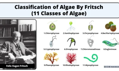
Classification of Algae By Fritsch (11 Classes of Algae)